A trip to Bamiyan through a wild country.
Together with some friends from Kunduz, who worked for an aid organisation, we wanted to travel to Bamiyan by land. We were aware that such a trip is not without risks. But after checking the current security situation we were reasonably confident that we could go. For the distance from Kunduz to Bamiyan one had to calculate 12 - 15 hours of driving and so we left before sunrise
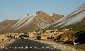
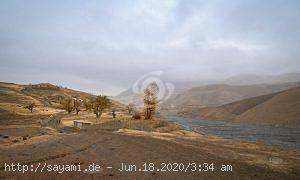
Shortly after Doshi you leave the paved road and move deep into the province of Baghlan, always along the river, the Darya-i-Qondoz, which had a lot of water during the spring thaw and the colour of well stirred cocoa.

The track behind Doshi could only be driven off-road, or over heavily damaged tracks. Unfortunately, the region is also one of the many no-go areas in the country, although it is one of the most impressive landscapes in the Hindu Kush. Especially in spring, when the rivers carry a lot of water and the valleys are fresh green, you can't help but be amazed.

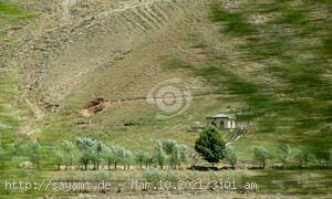
Along the route are many of the typical Afghan clay villages, where mostly farming families live. The valleys are fertile and so normally a lot of wheat and rice is grown. In between we stopped at beautiful places and sat down in the lush grass for a picnic, in the background always the sound of the river. But somehow we never remained undiscovered, always children appeared out of nowhere, who curiously watched us with an anxious distance and after a while dared to come closer.

Walking around in the green fields, many areas of poppy plants for opium production were discovered in between. Farmers often have no choice but to use the money to feed their families from opium cultivation.
The Afghan state does not have effective control over the region; on the contrary, the "Taliban" can act freely here and often push the farming families to cultivate their crops. For the farmers a lucrative business, and for the Taliban an even better business, they can buy weapons from the proceeds of the opium. Afghanistan is one of the largest opium and heroin exporters in the world. The profiteers include smugglers, corrupt officials - and last but not least the Taliban.

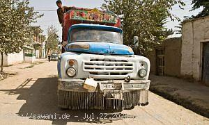
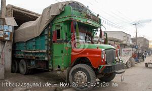
Potholes and again and again nasty potholes, that was inevitably part of this trip. But for hours it was exhausting and demanded a lot from head and body. Our two vehicles were also put under a lot of strain, so we have at least two spare tyres on board. We didn't use one.

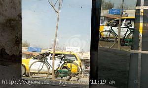
But we had to fill up on diesel. Halfway there was the only filling station in the small village Kalangozar. Actually we wanted to avoid stops in towns, but for refuelling we had no other choice. Our Austrian friend and my wife were not allowed to leave the vehicles, we didn't want to provoke an unpleasant situation. Under many observing eyes we filled up our tanks and drove on quickly.

The route was not always clear, there were no signs or similar markings. But our friends had a GPS device at hand, absolutely helpful at ambiguous crossings or in unclear places.

Again and again the track was flooded by the river, often it was not clear how deep the water was or how much the ground under the water surface would hold. At such passages only one of us drove in front, so that we could have pulled out the vehicle with the other car in an emergency case. Except for a small critical situation it always went well.

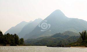
And then before sunset we saw the first mountain ranges of the Bamyian Valley, relief after 15 hours of driving for about 330 kilometers. The Bamiyan province with its meanwhile destroyed Buddha statues was a safe place and there was nothing to fear anymore. A strenuous but beautiful drive through enchanting landscapes and river valleys ended that day in the restaurant of the Roof Top Hotel, including a view to the empty niches of the Buddha statues.
The Kunduz to Bamiyan route
danke fürs “mitnehmen” auf diese Fahrt…
An incredible photographic series with incredible panoramic views! Sounds like getting around was treacherous at times.
Excellent photographic report, where the differences in life to make 330Km are very evident.
In Europe, with the motorways, these 330 km are done in less 3 hours. On these side of the world, it took 5 times more hours.
PS: With due differences, this mountain (first photo) resembles the Table Mountain that exists in South Africa.